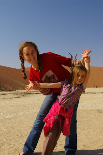
Since this would be our last day, we decided to sleep in a bit. So breakfast was at 8, or soon thereafter. At 9 we made our way to the Augrabies falls, in the Augrabies reserve. The falls are impressive in their own right, but with Victoria falls still fresh in our memory, it was hard to be impressed. Sorry. The falls must have been something else in January when the river flooded, and we saw the damage left behind. It is a pity that the repairs to the viewing platforms have not been done - do the parks management think they will heal themselves perhaps?
Damon found a Geocache about 3km down the river from the falls, still inside the park, so we went there to drop our last trackable. And we are glad we did - the view from there was spectacular. Or, as Shelby said, "Gorgeous".
Finally we had to admit that all our planned activities were done, and we had to head for home. 900km to go, so we set off at about 1pm. At 8pm we stopped for dinner at the Steers in Klerksdorp, an used the opportunity to officially clock our 8000km milestone (which we passed in the dark sometime earlier). And then the final leg home.
It has been an adventure. Good places, good friends, good experiences, good times. Good bye Zim Zam Nam!
Travel Blog for a trip through Zimbabwe, Zambia and Namibia, by the O'Reillys and the Joneses. June-July 2011.
Saturday, 16 July 2011
14 July 2011 - Fish River Canyon to Kakemas
Having learned from past experience, we decided to leave early because we have a lot of ground to cover today. But it was not meant to be. :( It was the Joneses turn to deal with a puncture. So, first thing in the morning Clinton was crawling around in the dirt changing wheels, while Curtis explained how to operate the jack.
We had chosen the path of least resistance, so we headed East 60 km to the tar road, and the rest of the day was on tar road - a nice change indeed. South toward Noordoewer border post. Vast open spaces, quiet roads, wait for the time to pass. About 5 kilometers before the border we clocked 7000km milestone. We stopped for our traditional milestone celebration. This time with the last of the sandy desert in the background, and the mountains of the Richtersveld on the other side of the Orange river. It was time to bid Namibia farewell, and so we crossed the border back into South Africa.
Our route took us to Springbok, then Pofadder, before arriving in Kakemas. "Why?" you ask? Mainly just to say we've been there. We have photographic evidence that we have visited those little towns that are so often the butt of jokes.
As we traveled through the Northern Cape we kept seeing these huge communal birds nests. Most of them are built on telephone poles because there are so few trees around, but some of the largest we saw were in trees. Eventually we had to stop and take a picture. We don't know what sort of birds these are, perhaps a more knowledgeable twitter can comment on this post to fill us in. Just look at the size of this nest that Damon is "holding up".
So, despite our efforts, we approached Augrabies rather late in the day, and decided we would leave the visit to the falls for the next morning. We went directly to our accommodation in Kakemas. Vergelegen Guesthouse gets our thumbs up! If you will ever be in the Kakamas part of the world and need a place to stay, stay at Vergelegen. If you are a family - you MUST have unit 16 - sleeps 6 at only about R1600 per night. And the restaurant is outstanding!
13 July 2011 - Luderitz to Fish River Canyon
We made an early start from Luderitz, leaving behind the Haus Sandrose which had been 'home' for two nights. We'll miss Haus Sandrose because it is the only place where we felt like we had the place to ourselves, and Jean really made us feel at home.
Driving up through the hills between the dunes as we left Luderitz the wind was blowing gusts of sand across the road, and it made the strangest patterns on the road in the early light. It almost looked like water running across the road. Seeing so much sand being moved by the wind it becomes clear why the dune desert is an ever-changing and shifting environment.
After a long stretch across the flats we approached Aus, and once again we took some time to get 'up close and personal' with the desert horses. In the end we had to tear Liesl away because she just wanted to stay with them all day.
After the horses we continued East to Aus, then took a turn through the tiny town, noting some very colorful local hospitality - B&B and Conference facilities, and then we turned south toward Rosh Pinah. Still on tar road - yay! The haul to Rosh Pinah was long, and at stages we could see straight road ahead to the horizon. The mountains of the escarpment rose on our left, and flat plains of grass on our right. Rosh Pinah provided fuel, and nothing more (trust us - you do not want to use the ablutions at that service station), and we proceeded south (now on dirt road) till we met up with the orange river.
Straight road, from here to the horizon, and on...
Then we turned left (East) and for about 50 or 80 km we drove along the banks of the Orange river. This drive was a somewhat surreal experience. The orange river in this area is only about 50 meters above sea level, but the surrounding country is 400 meters and more higher, so the river runs through a valley cut through the mountains of the Richtersveld. These mountains are not pretty. Actually, Janette said they are ugly. They look like piles of ragged rocks discarded by someone who had no use for them. There appears to be almost no life on the rocks, unless you look very carefully. So, while driving along the river, we had steep ragged rock faces rising on our left, the river on our right, sometimes close enough to touch, and then mountains rising up from the other side of the river again. Occasionally there are slightly flat bits in the bottom of the valley, and these host Namaqua daisies, dung beetles, and other odd bits of life. The drive along this route was recommended to us by a few people, who said it is extremely beautiful. I would find it hard to describe the scenery as beautiful, rather as rugged, out-of-this-world, and extreme. But definitely something you MUST see yourself."Ugly" mountains in the Richtersveld
In the odd flat space there are splashes of color
Driving between the rocks and a wet place
Later we turned left again heading North toward the Fish River canyon. We wanted to have a peak at Ai-Ais, but you have to pay to enter the resort, so we continued North to the Hobas reserve where the Fish River Canyon hike starts. we went to a few view points there. The Fish River canyon is second only to the Grand Canyon in its size (AFAIK). The views are amazing. I have a new respect for the people who have done the hike - 5 days in the bottom of a desert canyon - rather you than me! Clinton has now decided he WILL do the hike, and he decided Curtis is going with him.The whole gang at the Fish river canyon
We then moved on to the Canyon Roadhouse to spend the night. The Roadhouse is decorated around a theme of old cars, and they have really taken it to the extreme. But we all agreed it is well done, and it is interesting to see all the old car-memorabilia around the place. Special note - when you use the rest rooms here, please control your curiosity! (Anyone who has been there will know what I mean!)The Canyon Roadhouse in the evening, soon after we checked in
Novel fireplace in the dining room
Tuesday, 12 July 2011
12 July 2011 - Luderitz and Kolmanskop
The photographic enthusiasts among us woke very early today to be at Kolmanskop before sunrise. "Why?" you ask? Well, we are not mentally very well...
Kolmanskop is the small ghost town in the desert, which you have probably seen photographed before, about 12 km outside Luderitz. The diamond mines were abandoned about 70 years ago, and since then the little village has been abandoned to the desert. The old houses are now just skeletons over-run by the shifting dunes. The ghostly, abandoned look of the place has attracted many photographers over the years, and so we followed suit. The town is on a hillside facing East, and so at sunrise the first rays of the sun provide interesting views throughout the town. This is why we had to be up at 5, and on site by about 6:15 am. The photographers were Damon, Kevin and Curtis, and I was the driver.
Waytag at the top of Kolmanskop overlooking the town
The rest of the family joined us for the official tour at 9:30 am, and after that we continued wandering the dusty streets till about noon.
After Kolmanskop we drove north of Luderitz to Agate Beach. You are supposed to find agate stones on the beach there. None of us are 100% certain what agate is, so we don't know if we found agate on the beach, but we did find a lot of pretty sea shells. Clinton reckons we did, so I'll take his word for it. I did NOT get the Fortuner stuck this time, so it was a successful beach-pedition all round.
It was now approaching mid-afternoon, so we decided we should go to the coffee shop around the corner from our accommodation - Diaz Coffee Shop. Our first failure for the day - please skip Diaz Coffee shop. The girls are certain that the cakes there were bought 3 days ago at the local Spar.
Next stop - Diaz point. This is one of the places where Bartholomew Diaz placed a cross claiming the land for the Dutch. He was here in 1488. There is also supposed to be a light house and a coffee shop at Diaz point. Well, there is a light house, but it is rather plain, and really does not appeal to photographers. And the coffee shop is no more. Anyway, the Cross marking the spot claimed by Diaz was there on a high rock over the ocean, so we walked up there for a view of the ocean. There were a few seals about, evidenced by the sound (some barking like dogs and some sounding like sheep) and by the distinctive aroma of seals.
We also found another geocache here, so we dropped off one of the trackables that we had picked up earlier in our journey.
By this time we were all running out of steam, so we returned to Haus Sandrose to recuperate. Janete made some flapjacks, which we had with options of chocolate ice-cream, melted chocolate sauce or grated chocolate shavings. Or cinnamon and sugar. Death by chocolate! Then we relaxed till dinner time at the Restaurant at the local Protea Hotel. Dinner was interesting - dodging all the items on the menu that were 'out of stock'. But once we ordered food they actually had it was quite good.
Kolmanskop is the small ghost town in the desert, which you have probably seen photographed before, about 12 km outside Luderitz. The diamond mines were abandoned about 70 years ago, and since then the little village has been abandoned to the desert. The old houses are now just skeletons over-run by the shifting dunes. The ghostly, abandoned look of the place has attracted many photographers over the years, and so we followed suit. The town is on a hillside facing East, and so at sunrise the first rays of the sun provide interesting views throughout the town. This is why we had to be up at 5, and on site by about 6:15 am. The photographers were Damon, Kevin and Curtis, and I was the driver.
Waytag at the top of Kolmanskop overlooking the town
The rest of the family joined us for the official tour at 9:30 am, and after that we continued wandering the dusty streets till about noon.
After Kolmanskop we drove north of Luderitz to Agate Beach. You are supposed to find agate stones on the beach there. None of us are 100% certain what agate is, so we don't know if we found agate on the beach, but we did find a lot of pretty sea shells. Clinton reckons we did, so I'll take his word for it. I did NOT get the Fortuner stuck this time, so it was a successful beach-pedition all round.
It was now approaching mid-afternoon, so we decided we should go to the coffee shop around the corner from our accommodation - Diaz Coffee Shop. Our first failure for the day - please skip Diaz Coffee shop. The girls are certain that the cakes there were bought 3 days ago at the local Spar.
Next stop - Diaz point. This is one of the places where Bartholomew Diaz placed a cross claiming the land for the Dutch. He was here in 1488. There is also supposed to be a light house and a coffee shop at Diaz point. Well, there is a light house, but it is rather plain, and really does not appeal to photographers. And the coffee shop is no more. Anyway, the Cross marking the spot claimed by Diaz was there on a high rock over the ocean, so we walked up there for a view of the ocean. There were a few seals about, evidenced by the sound (some barking like dogs and some sounding like sheep) and by the distinctive aroma of seals.
We also found another geocache here, so we dropped off one of the trackables that we had picked up earlier in our journey.
By this time we were all running out of steam, so we returned to Haus Sandrose to recuperate. Janete made some flapjacks, which we had with options of chocolate ice-cream, melted chocolate sauce or grated chocolate shavings. Or cinnamon and sugar. Death by chocolate! Then we relaxed till dinner time at the Restaurant at the local Protea Hotel. Dinner was interesting - dodging all the items on the menu that were 'out of stock'. But once we ordered food they actually had it was quite good.
Monday, 11 July 2011
11 July 2011 - Keetmanshoop to Luderitz
We took today more easily than most, as we have only about 3 and a half hours of traveling to do. We went to see two local attraction near Keetmanshoop - the Quiver Trees and the Giant's Playground.
Quiver tries are a type of succulent that grows in the area. They are really strangely attractive plants, that look very much like a tree, though clearly they are not. They are a type of Aloe. Apparently they take hundreds of years to grow to a mature size, and they manage to survive all those years in arid desert conditions. While here, Robyn built a stone tower beneath a Quiver tree for her friend London in Texas. London - see the photo of Robyn's construction for you...
The Giants playground is supremely odd. Imagine a kid with a bunch of toy blocks, who stacks them in a haphazard way to build some sort of structure, but leaves it looking half done. Then multiply the size by a LOT and you begin to get an idea of what this place looks like. The rocks here have naturally eroded in this strange way that leaves the landscape looking like a giant's playground. And Clinton pointed out an interesting thing - some of these rocks ring like a gong or bell when you hit them with a hammer or another hard stone.
Then we turned West toward Luderitz. After a while we hit our 6000km milestone, this time without any destroyed tires or bumpers, but with a cracked windscreen! We polluted the road and a nearby railway line with our bodies to commemorate the milestone, and then we pressed on.
We stopped After passing Aus as we found some of the famous Desert Horses that live wild in this area. We spent some time photographing the horses here before moving on Westward.
Approaching Luderitz the landscape become more barren, and then very rocky as we entered the dunes again. This area combines rocky desert with dunes to give a unique and very hostile looking combination. We passed Kolmanskop - we'll be returning there tomorrow for photos and a tour.
We found Haus Sandrose where we will stay two nights - comfortable and spacious, with the garden to ourselves. And Internet!!! We're in touch with the world again, and updating the blog tonight.
10 July 2011 - SossusVlei to Keetmanshoop
We were up very early to breakfast and enter the Sossus Vlei reserve by 7am.
In the Sossus Vlei reserve you have to drive 60 km from the gate to get to the vlei, and even then you are still a few km short of the destination. So by about 8:30 am we arrived at the parking area where you must leave your vehicle, unless you have a proper 4x4 to go further on the dune sand. We chose to use the shuttle service from this point, so we bundled ourselves onto the back of a land rover and went for the bumpy ride to Dooie Vlei, and then Sossus vlei.
First stop - Dooie Vlei (Dead Pan - no kidding!). The shuttle dropped us off and the guide pointed us south and said walk over those dunes about 1 kilometer, and there will will find it. so we did. Dooie Vlei is amazing. It is an almost other-worldly experience, because the landscape is just so weird. You have red dunes all around, a dry pan which is almost white and completely flat, and then all these dead trees standing like stark skeletons in the pan. OK - again the descriptions fail us, so check out some selected photos.
Next stop - Sossus Vlei. This time the shuttle brought us closer to the destination. Sossus Vlei actually has water in it, which is very unusual in winter, but is yet more evidence of the very high rainfall this year. The water is a milky-murky color, which explains why the vlei becomes so white when the water dries out - it carries this fine white dust in suspension. There is a huge dune which projects right into the vlei so that the vlei forms a huge horseshoe shape around it. Clinton had had Jungle oats for breakfast, so he decided to climb the dune, while the rest of us mere mortals stayed closer to vlei-level. There was a Jackal skulking around the vlei area, which means we have now seen Jackals in Etosha, in the Damaraland desert, and in the Namib desert area. They seem to like these conditions.
As there has been good rain and there is still water, there is some green vegetation around, and so we had some really interesting pictures with red dunes, white vlei, brown sand desert, green plants and blue sky. It is difficult to describe how such desolation can be beautiful, but it really is.
About 1 pm we finally dragged ourselves away from Sossus, fueled up and drove over 500 km on good sand roads and then tar roads to get to Keetmanshoop by soon after 6pm. We were booked to stay at Birds Mansions. When we pulled up outside we were a little apprehensive - I had flashes of David Kramer strumming and singing "Die Manne van die Royal Hotel". But it turns out that Birds Mansions has been renovated, and though it has old bones from a bygone era, it was really very comfortable, and the interior is quite contemporary.
We met Brian Venter (a Namibian brother who is pioneering and serving the congregation in Keetmanshoop) for dinner. Brian said he has been following the blog (yay - one follower at least!), and so he told us about some of our adventures. And then we crashed.
9 July 2011 - Swakopmund to Namib Desert
We got on the road out of Swakopmund soon after 8 am. Clinton suggested we take the route to Walvis via Dune 7, which is a salt road which runs to the East of the dune field between Swakop and Walvis. It was a nice drive, with some photo opportunities, and it ends with a really beautiful view of Dune 7 - much better than the view that most people have from the other side. Dune 7 is supposed to be the tallest dune (as far as we know) so it is an impressive sight indeed.
Then we turned South East into the desert. And desert it is. And the further we went the more deserted it became. Over 200 km passed before we got to Solitaire (yes - that's the name of a town in the Namib desert). Somewhere in those 200 km we passed through two impressive river gorges - the Kuiseb pass and another one which shall remain nameless due to our collective amnesia. Both are beautiful, barren, rugged, and featured water, but not much of it. The rest of the distance was among vast plains of grass (usually just sand, but due to the high rainfall this year they are covered with a soft but tufty grass that is about knee-height, and looks good when the wind blows over it in waves), and between mountains of rugged sand-stone.
Occasionally a dried-up river is shown by the presence of trees which follow the river's course, and these isolated trees make in interesting view against the inhospitable looking environment.
We crossed the Tropic of Capricorn, headed south. We stopped in Solitaire to 'freshen up', and for drinks and snacks.
Solitaire consists of a camping site, a very old service station, a 'general dealer' (yes - that's what is written on the building) and a bakery. That's about it. If you blinked you missed it.
Then we pressed on to Sossus Vlei. We paid the permits and were about 10 km along the tarred road toward the vlei when I picked up something very sharp and hard which sliced right through my left rear tire. I've never seen that happen to a tire - a gash more than 5 cm wide sliced clean through the steel belt in the tread of the tire. Whatever object it was, it was thrown up against the rear bodywork and smashed a piece out of the bumper too. Never to have their spirits dampened, the kids celebrated our "5,000 km milestone" on the side of the road while I was crawling round in the dirt replacing the tire. How ironic that we clocked our 5000km as we entered Sossus Vlei, with probably more than half that distance on dirt roads, and then on this neat piece of tar road we experienced our first tire problems!
We put on the spare and turned back, as with this delay we would not have time to get to the vlei, have a decent view, and still get back out before the gates close at 17:15. We pleaded our case with the gate officials, and they kindly issued us a permit to re-enter on the 10th since our visit today had come to naught.
Right outside the entrance to Sossus Vlei is an Engen service station, and they keep tires. I was surprised, but in hindsight, in country with so many dirt roads, it is not surprising that the people are prepared for this sort of thing.
The guys there wanted to rush me nearly N$5,000 for a new tire, but I cried and begged and pleaded, and eventually we got a new spare fitted for N$2,800. Note - when we arrived I saw another customer having a puncture repaired, and while we were there another woman was paying for a repair completed earlier in the day. If you are wanting to move to Namibia, and you don't know what work you'll find - here's a hint: Tires!
Then off to the Namib desert lodge, hot-dogs for supper and an early night so we can do Sossus Vlei early in the morning.
Friday, 8 July 2011
8 July 2011 - Swakopmund Day 3 - Whales in Walvis
We made an early trip through to Walvis Bay this morning, and enjoyed a cruise in the Bay on a Catamaran. On our way out we saw seals and Benguella dolphins. The seal colony in Walvis is now about 50,000 strong, though it did not exist 15 years ago. We spent some time among the dolphins. They love to swim along near the bows of the boat. They were not very active today, so they were not jumping a lot, but we managed to catch them in the air a few times.
We went out beyond the bay in search of whales which have been spotted in the area recently. But paradoxically two hump-back whales were spotted by other boats in the bay, so we made a mad dash back. We were able to sail alongside the whales for about half an hour before we had to turn for home.
We finished the cruise with oysters and other snacks en route to the harbor. Some days I'm really glad that no one else in the family enjoys oysters. All the more for me. I had to fight Clinton off of course, but we both had more than we needed.
In the afternoon the guys visited the Reptile park in Swakop, owned by Stuart Hebbard. We were able to see a huge variety of reptiles, including snakes, lizards, geckos, chameleons, etc. The girls were souvenir hunting instead - reptiles give them the creeps.
Finally we went to the beach at Mile 8 in search of pretty pebbles, and it was already time for sunset. We found a lot of round stones, and a dusky beach.
Subscribe to:
Posts (Atom)